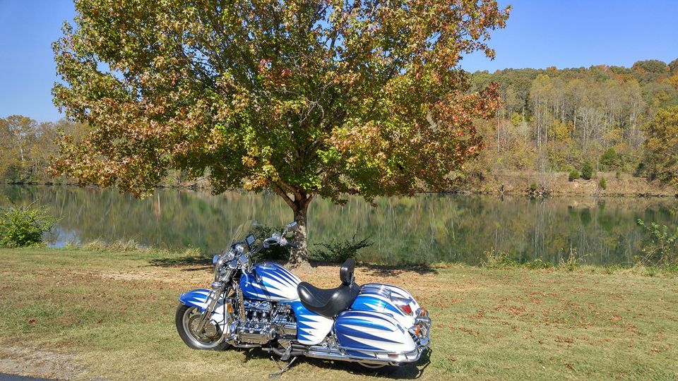
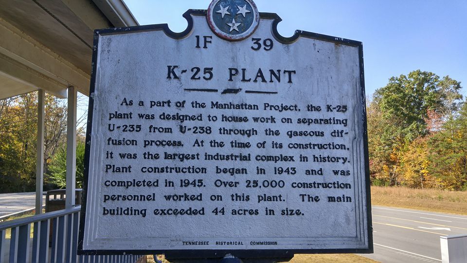
My wife fell on the porch steps on Sunday 10/16 and broke her back . I've been out of work and homebound after getting her out of the hospital since then. Yesterday her sister came up to visit and that gave me a chance to get some wind . The weather here in The Great State Of Tennessee is awesome right now with record and near record high's with nothing but sunshine ( we really need some rain BAD ) . I rode 150 miles and was never over 35 miles from the house just doing loops around the hood. First stop was near the Secret City. First picture taken off the WWW and show's K-25 back in the day . With Russia pulling its crap now I think the day could come when someone in power here in America claims " You know tearing down K-25 wasn't that good of idea " .
K-25 was the codename given by the Manhattan Project during World War II for the project to produce enriched uranium for atomic bombs using the gaseous diffusion method. Originally the codename for the product, over time it came to refer to the project, the production facility located at the Clinton Engineer Works in Oak Ridge, Tennessee, the main gaseous diffusion building, and ultimately the site. When it was built in 1944, the four-story K-25 gaseous diffusion plant was the world's largest building, with over 1,640,000 square feet of floor space and a volume of 97,500,000 cubic feet .The code name "K-25" was a combination of the "K" from Kellex, and "25," a World War II-era code designation for uranium-235 (derived from element 92, atomic mass 235). The term was first used in Kellex internal reports for the end product, enriched uranium in March 1943. By April 1943, the term "K-25 plant" was being used for the plant that created it. That month, the term "K-25 Project" was applied to the entire project to develop uranium enrichment using the gaseous diffusion process. When other "K-" buildings were added after the war, "K-25" became the name of the original, larger complex.Demolition of K-25 was complete in 2012.

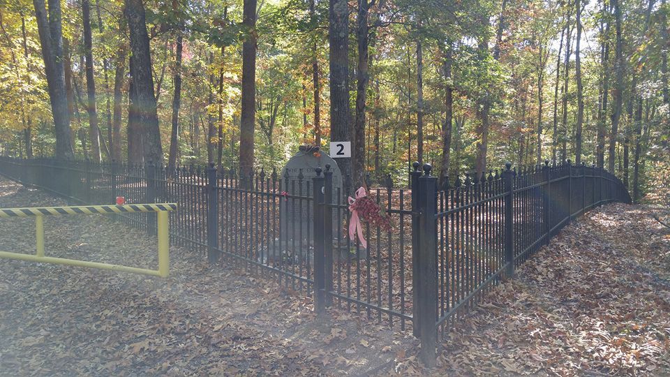
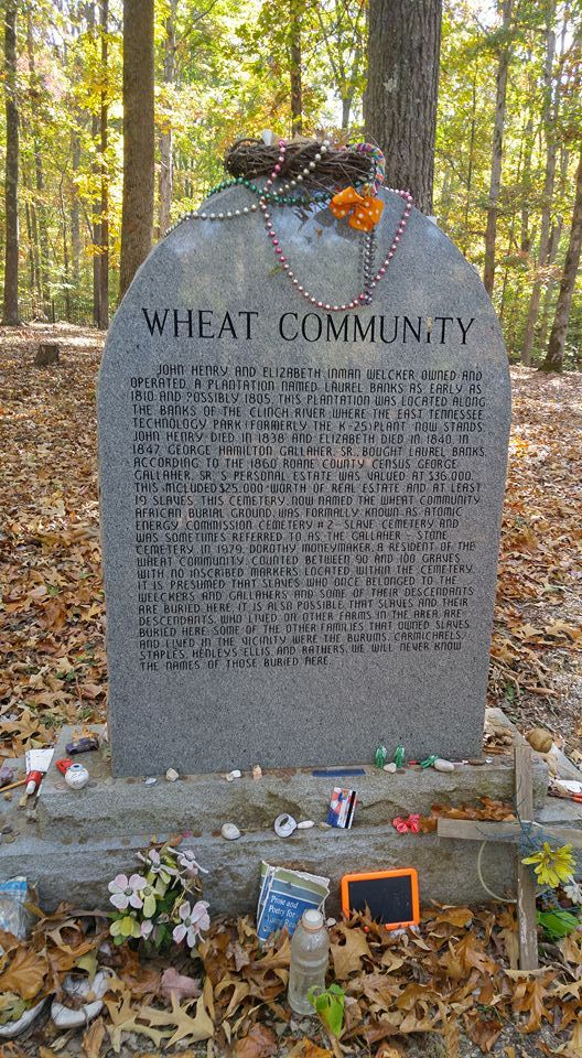
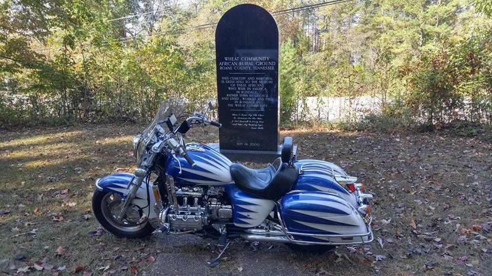
Next stop was at the African Community Burial Grounds ...Wheat was a farming community in Roane County, Tennessee. The area is now in the city of Oak Ridge.
The earliest settlers moved into the area in the late 18th century. However, it was not until 1846 that the area was established as the community of Bald Hill. The name was changed to Wheat in 1880, when a post office was opened and the community took the name of its first postmaster, Frank Wheat.
Early farming residents included John Henry and Elizabeth Inman Welcker. They owned Laurel Banks plantation on the Clinch River from the early 19th century until c. 1840. Records from the time show that the Welckers were active in the purchase and sale of slaves. George Hamilton Gallaher purchased the property in the 1840s, and it is now referred to as the Gallaher-Stone Plantation. The Wheat Community African Burial Ground (AEC #2) and Gallaher-Welcker Cemetery (AEC #1) still survive. The African Burial Ground was long forgotten, but the site was found in 2000 by Will Minter and was cleaned up and marked by U.S. Department of Energy personnel and volunteers. At least some of those buried in the African Burial Ground are believed to have been part of the Gallaher-Stone Plantation; a monument to those held in slavery is on the cemetery grounds. Numbers vary however its somewhere around 100 slaves are buried here.
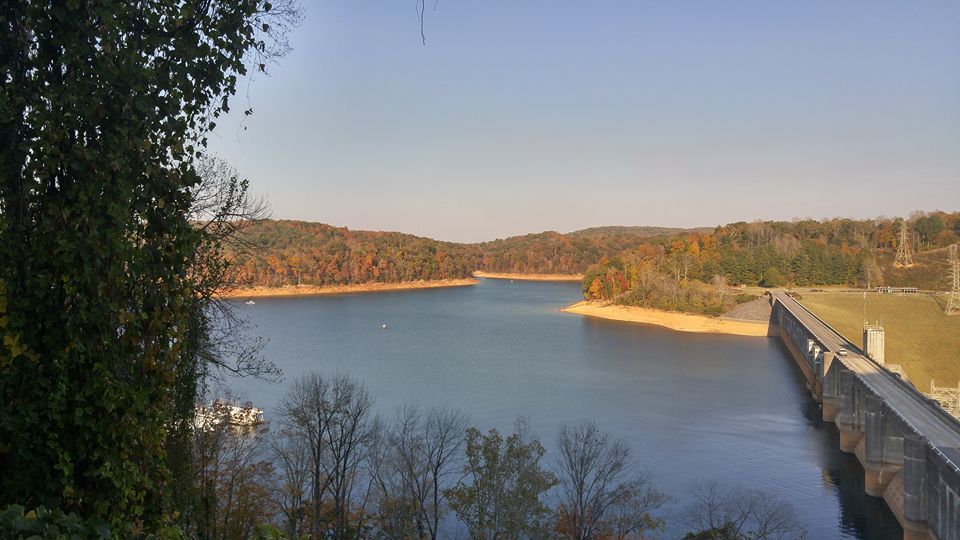
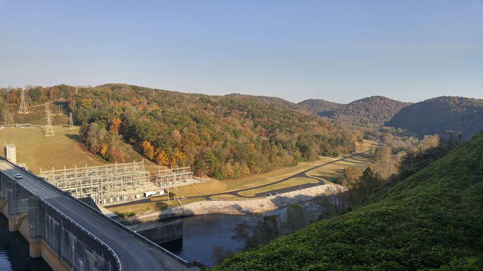
This is Norris Dam my Grandfather worked here building this in the 30's some of you that know my friend Gordon ( Lucky 13 ) his Grandfather was killed here during construction when he fell in a rock crusher. Not only did my Grandfather work here during construction he also worked at the K-25 site pouring concrete after the dam was built. He returned to work here at Norris Dam and I think I remember him saying he worked 44 years for TVA. Norris Dam is a hydroelectric and flood control structure located on the Clinch River in Anderson County and Campbell County, Tennessee. Its construction in the mid-1930s was the first major project for the Tennessee Valley Authority, which had been created in 1933 to bring economic development to the region and control the rampant flooding that had long plagued the Tennessee Valley. The dam was named in honor of Nebraska Senator George Norris (1861–1944), a longtime supporter of government-owned power in general, and supporter of TVA in particular. The project infrastructure was listed on the National Register of Historic Places in 2016.
Norris Dam is a straight concrete gravity-type dam. The dam is 1860 feet long and 265 feet high. Norris Lake, the largest reservoir on a tributary of the Tennessee River, has 33,840 acres of water surface and 809 miles of shoreline. The dam has a maximum generating capacity of 132,000 kilowatts.
" The Money Shot " taken near Melton Hill Dam ... The weather is outstanding and I'm hoping to get back in the wind as soon as my wife can do for herself she goes back next week for all the staples to come out .... I love this old bike .... LONG LIVE THE DRAGON.