Valkyrie Riders Cruiser Club
July 10, 2025, 09:40:14 AM *
Welcome, Guest. Please login or register.

Login with username, password and session length
Ultimate Seats Link VRCC Store
Homepage : Photostash : JustPics : Shoptalk : Old Tech Archive : Classifieds : Contact Staff
News: If you're new to this message board, read THIS!
 
Inzane 17
Pages: [1]   Go Down
Print
Author Topic: Rode for a couple of days on the BRP and other roads  (Read 895 times)
..
Member
*****
Posts: 27796


Maggie Valley, NC


« on: July 14, 2020, 09:39:31 AM »

Starting gas fill up


Sunday morning I had planned to meet Smokin Joe and others in Cherokee, NC around 12.30p.m. to ride along with them to Asheville. I was going to continue on while the others split off into Asheville.

Ride day morning and the same affliction that affects others hit me. I woke early and was ready to roll.

I got to Cherokee early (no suprise) texted Joe that i was already on the BRP and away I went.

Beautiful day and I could feel the air cool as the road took me to higher elevations.

All is going well until I round a bend and ahead of me is a land behemoth RV. I've driven the same model and I know it's height including the A/C units etc on the roof. 12ft 6 ins! The driver is straddling the center line to avoid low hanging branches and he's doing this on blind bends!

After a couple of miles he's able to pull int an overlook large enough for the RV and towed Jeep. I hoped he would be able to navigate the tunnels without having to cross the center line. Some of them have blind bends and the RV will be an unpleasant shock for oncoming traffic.

The open road is ahead of me. Yippee!

But not for long. No foreign vacation travel for Americans and it seems that a lot of them have decided the southern Appalachian mountains are a prime vacation destination. Oh well it gives me an opportunity to mosey along. Take in the scenery. Pull into overlooks for photos.

Most of the slow pokes are kind and pull off so I can continue unimpeded. But this poses a dilemma as far as photo opportunities. I don't want to pull in behind them and seem ungracious about their willingness to remove their vehicular impedance.

This dilemma is soon resolved for me as I see the pull offs with the most spectacular views are slammed full of vehicles of all shapes and sizes. Not much social distancing going on and very few face masks to be seen.

I do stop for the obligatory highest point photo even though I have many of these.


The parking lot at Black Balsam is full and there are dozens of cars parked on the grassy verges.

The pull off at Skinny Dip Falls is also full and cars are parked on the verges. Not much distancing or mask wearing to be seen here.

A gas stop in Asheville and now I'm among mask wearers. After the fill up I enter the building and am sternly told I must wear a face mask. I point to the closed face shield on my helmet and inform the clerk the solid face shield is a lot more effective than his cloth face mask. He repeats that I must wear a face mask so I turn and exit the building. A conversation not worth having.

I am looking forward to riding up Mt. Mitchell. The blue sky with cotton wool ball clouds promises clear views across the Appalachians.

Now I'm stuck behind a slow poke Jeep with a Texas licence plate. I'm hoping they don't turn onto the Mt. Mitchell approach road but I have a sinking feeling that they will. If that happens I will just ride on.

The road widens into 2 lanes so that left turning vehicles wont impede those wishing to continue northwards.

What the ............ There are traffic cones blocking the entrance and a large hand written sign states "Park Full".

I jink right and zip past the Jeep before it can realize they too have to continue on.

I've ridden up or past Mt. Mitchell dozens of times over the years and have never seen the entrance closed. Not even on a good weather public holiday.

All these people. My aluminum foil hat slips and I wonder if the NC governor has extended his mask mandate to a shut down again and people are getting out whilst they can.

I do understand why the BRP was closed last time. People can't seem to understand simple social distancing and some continue to be of the opinion that they will never catch the plague.

Onwards and forwards.

A good few miles pass beneath my wheels and I'm enjoying running at a good speed zipping by the full overlooks.

Now I'm behind a parade of 1. A Harley. This is  not a slam to all Harley riders. Just this one.

Weaving across the road his riding style is to twist the throttle (convert petroleum into noise without an increase in speed) and then let go of the throttle and shake his right hand.

Once slowed he accelerates again while shaking his left hand.

And repeat. With backfires as the bike slows.

Whenever there's an opportunity for me to legally pass on a dotted line he makes sure I can"t by accelerating hard.

My history of tickets makes me refrain from just zooming by and showing him the Valkyrie power.

I don't know if he needed to shake both hands at the same time but after about 15 miles he pulled into an overlook.  Smiley

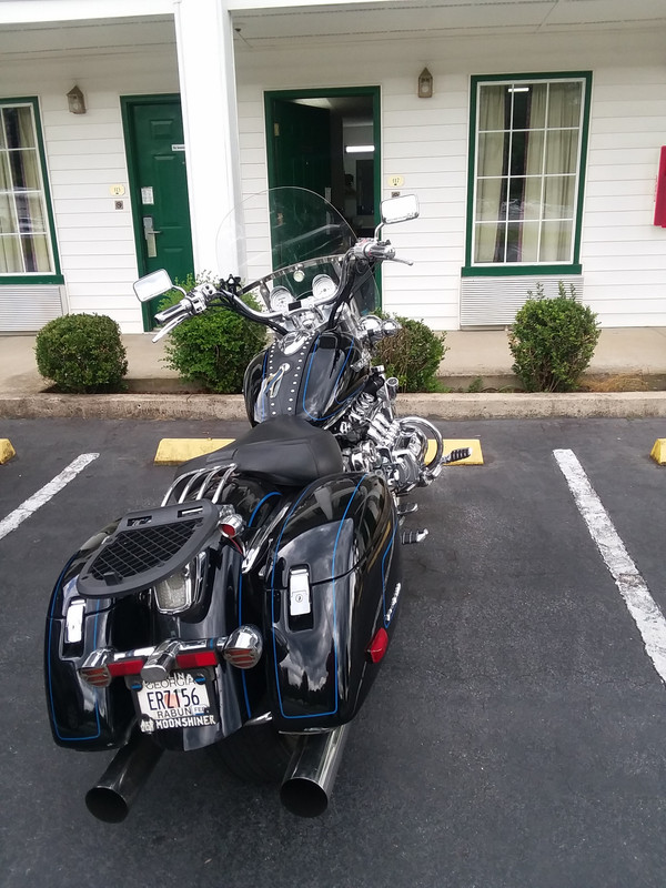
I spend the night in Lenoir at the American Motel. At registration I am asked to sign a plague affidavit that I haven't traveled from, been with, have a fever and other questions.


I opened the room door to leave for dinner to find a deluge. A look at the Raindar app shows a thunder cloud positioned directly over Lenoir.


See my route here.

https://www.relive.cc/view/v1vjpzwBBY6


« Last Edit: July 14, 2020, 11:58:31 AM by Britman » Logged
Oss
Member
*****
Posts: 12613


The lower Hudson Valley

Ossining NY Chapter Rep VRCCDS0141


WWW
« Reply #1 on: July 14, 2020, 10:56:18 AM »

thanks for the ride report Paul
Logged

If you don't know where your going any road will take you there
George Harrison

When you come to the fork in the road, take it
Yogi Berra   (Don't send it to me C.O.D.)
Wizzard
Member
*****
Posts: 4043


Bald River Falls

Valparaiso IN


« Reply #2 on: July 14, 2020, 11:10:33 AM »


great report Paul. Enjoyed it  cooldude
Logged


VRCC # 24157
Valkorado
Member
*****
Posts: 10499


VRCC DS 0242

Gunnison, Colorado (7,703') Here there be twisties.


« Reply #3 on: July 14, 2020, 11:44:22 AM »

Good report Britman, I can sure relate to the, er -- constipated roads.  It's been an obstacle course, and the short mountain passing zones ensure some serious gear dropping and temporary high RPMs!  It's all good, I guess.  I don't see it ever changing.  The Gunnison Valley has been fully "discovered".
Logged

Have you ever noticed when you're feeling really good,
there's always a pigeon that'll come sh!t on your hood?
- John Prine

97 Tourer "Silver Bullet"
01 Interstate "Ruby"

..
Member
*****
Posts: 27796


Maggie Valley, NC


« Reply #4 on: July 14, 2020, 11:59:20 AM »

DARN IT. Day 2 disappeared. I'll have to recreate it.
Logged
henry 008
Member
*****
Posts: 1531


BRP

willard, oh


« Reply #5 on: July 14, 2020, 12:02:25 PM »

 cooldude
Logged

Safe Winds... Brother

..
Member
*****
Posts: 27796


Maggie Valley, NC


« Reply #6 on: July 14, 2020, 12:20:23 PM »

On the road again 9 o'clock Monday morning.


I have no route planned. Just going to follow my front wheel and see where that takes me. I will be on roads previously ridden but some were hears ago so I'm looking forward to what changes may ahve happened. Good or bad.

After getting gas I head east on Hwy 268 towards Wilkesboro. The road runs near to the Yadkin River which meanders and affords the occasional glimpse and a couple of bridge crossings. The Yadkin Valley is beautiful and there are a lot of farms and the area has become quite well done for its winerys.

https://www.wncsculpture.org/

https://en.wikipedia.org/wiki/Yadkin_River

https://en.wikipedia.org/wiki/Yadkin_Valley_AVA

This reminded me of Oklahoma and Kansas (KS 400 aaaargh! Inside joke for some).


The Yadkin was dammed to form the Kerr Scott Reservoir.

https://en.wikipedia.org/wiki/W._Kerr_Scott_Dam_and_Reservoir

Before I get to the reservoir I see a sign for Mountain Overlook. I've previously led a couple of rides along this road but at a speed greater than my moseying rpm today. This is the fist time I've noticed the sign.


What a surprise from the overlook. The ridges of the Blue Ridge Parkway can easily be seen. Far in the distance to the left Mt. Mitchell is visible.


https://www.youtube.com/watch?v=EkgsTFGV7Tk


Further along 268 there's access to the reservoir.


A short ride to the east gives me access to the dam itself.


There must be at least 1 church per mile along 268.

On to Wilkesboro. I've only ridden about 30 miles along 268 but being dumped onto a 4 lane in Wilkesboro  is a jolt to the senses.

Get me out of here!

Eventually Hwy 16 lifts me up and away from the traffic and heat back to the soft mountains.

A short ride along the BRP and a turn north into Laurel Springs. I hoped to have breakfast at Freeborns/Station Inn. Unfortunately due to the plague they are only serving food Fri, Sat and Sun.

http://www.thestationsinn.com/

https://freebornes.com/

I'm told there's a place open a few miles up the road but I don't see anything.

Arriving in Sparta NC I see JB's Pizza and Subs is open and it's lunchtimeish.

They are as busy as a bunch of one armed paper hangers. it takes 30 minutes to get a burger and fries but the A/C is on in the building and it's hot outside.

JB's is at the front of the Allegheny Inn parking lot which I think has been ground zero for a few Valkyrie rides.

https://www.alleghanyinn.com/

Cooled down and fed I'm headed for Volney, VA where I want to pick up Hwy 58 to Damascus and on to Shady Valley through Backbone Rock.

Along the way I turn into Grayson Highlands State Park.

https://www.dcr.virginia.gov/state-parks/grayson-highlands#general_information


https://www.tripadvisor.com/Attraction_Review-g55331-d1546643-Reviews-Backbone_Rock-Shady_Valley_Tennessee.html

From Shady Valley I head south east along TN 421 the "Snake" to Mountain City.

http://www.thesnake421.com/snake-421-ride-information/

The Snake is traffic free, gravel free and a blast to ride in 3rd using the bikes torque from 2,500 to 5,000rpm.

In the past I've mainly ridden from Mountain City to Shady Valley so it's a real pleasure to "see" the road from the other direction.

From Mountain City it's a short ride past Lake Watauga on Hwy 67 to Hwy 321 and then to rejoin Hwy 421 for about half a mile to my next turn on the right.

This short distance takes about 20 minutes. There's a cluster of red and blue flashing lights ahead at the turn I want to make.

My lane is pushed to the left to pass the emergency vehicles. As I make the turn onto 194 I see a black sports bike crumpled on the grass and a pick up truck with crushed front. The truck is facing north and it looks like the pick up made a left turn across the sports bike.

Hwy 194 used to be a roller coaster ride with quite a few extreme switchbacks. Some so tight that it felt like the bike was going to fall over and lean on the other lane. There are numerous gouges in the black top from vehicles who miscalculated their maneuver.

Some of the bends have been sanitized and smoothed out with accompanying metal crash barriers. Not the pulse quickener it used to be.

Wanna a live in business? This has a for sale sign outside.

https://www.taylorhouseinn.com/

The plague has closed the Mast General Store. I hope this is temporary.

https://www.mastgeneralstore.com/cms/index.cfm/visit/valle-crucis/


I ride into Banner Elk. The first store I see is a Dollar General. The usual bright yellow and black corporate sign is toned down to this

https://s3-media1.fl.yelpcdn.com/bphoto/L0RQj12YI8wPyzC8rhdw4Q/ls.jpg

Banner Elk is also home to

http://eaglesnestatbannerelk.com/


« Last Edit: July 14, 2020, 01:23:52 PM by Britman » Logged
..
Member
*****
Posts: 27796


Maggie Valley, NC


« Reply #7 on: July 14, 2020, 01:28:26 PM »

That is a great video.  It is rare to have that kind of visibility in the Summer, looking at or from Mt. Mitchell.  Usually you are up in a haze.  

Paul, sorry you couldn't get to the top of the mountain.  You know there isn't much parking up there, as nothing is flat.  You could have parked your bike close to the park entrance and hiked up the trail if you chose to.

You do know that it's 4.5 miles UP the mountain from the BRP by road???

The parking is for about 100 cars and is pretty flat. You got the right mountain?
Logged
..
Member
*****
Posts: 27796


Maggie Valley, NC


« Reply #8 on: July 14, 2020, 03:34:00 PM »

Long story short.

I wanted to be away from all the people on the roads so I did a dash for home. Up and over Black Mountain on I 40 is always fun.

Here's the Relive route. The GPS had a couple of hissy fits hence the straight lines.

https://www.relive.cc/view/vrqDm54ZmLv
Logged
hubcapsc
Member
*****
Posts: 16781


upstate

South Carolina


« Reply #9 on: July 15, 2020, 04:39:04 AM »

I was at the highest point at 2:00pm on Sunday... I've taken many pictures
there as well, but Sunday there were giggling college girls climbing
on it...


You can count on Joe ALWAYS stopping at the highest point, so I waited there
for a few minutes in case his crowd came by, but never saw them until
they showed up at the motel.

You can also  count on Joe stopping at Mount Mitchell, so we
were there Monday, it was not full then...


Once I was passing by Wilkesboro  on a Sunday at 11:00 on hwy 16, returning
from a ride, and came by a Baptist Church that was filling up. I stopped in and
that joker preached until past 1:00... My preacher starts getting the stink-eye
from all the hungry people if he goes much past 12:00...

-Mike
Logged

..
Member
*****
Posts: 27796


Maggie Valley, NC


« Reply #10 on: July 15, 2020, 08:13:52 AM »

I was at the highest point at 2:00pm on Sunday... I've taken many pictures
there as well, but Sunday there were giggling college girls climbing
on it...


-Mike

Opposite the sign there were a couple of older women and young boys at the top of the short cliff. I assumed grandmothers and sons. They proceeded to butt shuffle down the water worn groove slowly and carefully. Myself and a few other instant spectators stood and watched until they made it back down to flat land.
Logged
Pages: [1]   Go Up
Print
Jump to: