We hooked up in my hometown of Clinton in The Great State Of Tennessee this morning. Larry ( Yamaha ) David ( Harley ) Dave who rode down from Kentucky to join us on his Valkyrie. What a awesome beautiful day it was for this time of year in the south with low humidity I " kinda " got cold as we hit the 5,000 feet elevations . This first picture was taken in Tellico Plains, Tennessee at The Biker Shed as you enter the Skyway.

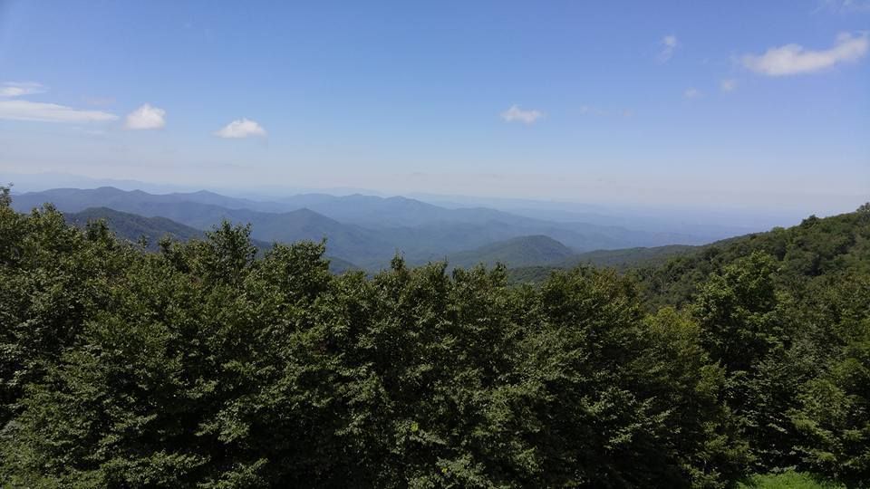
These next pictures was taken on Cherohala Skyway . The Cherohala Skyway National Scenic Byway and National Forest Scenic Byway that connects Tellico Plains, Tennessee, to Robbinsville, North Carolina. Its name is a portmanteau of Cherokee and Nantahala, the two national forests through which it passes. Along with multiple vistas and overlooks, the skyway provides easy vehicular access to various protected and recreational areas of the Unicoi Mountains, including the Citico Creek Wilderness, the Bald River Gorge Wilderness, and the remote interior of the Joyce Kilmer Memorial Forest.
Planning for the Cherohala Skyway began in 1958 and the road was completed on October 12, 1996 at a final cost of one hundred million dollars. The western (or Tennessee) half of the skyway follows Tennessee State Route 165 for nearly 25 miles from Tellico Plains to the state line at Stratton Gap. The eastern (or North Carolina) half follows North Carolina Highway 143 for just over 18 miles from Stratton Gap to Robbinsville. The skyway gains over 4,000 feet in elevation, rising from a low point of just under 900 feet at Tellico Plains to a high point of just over 5,400 feet on the slopes of Haw Knob near the Tennessee-North Carolina state line. The North Carolina half of the skyway terminates near the south shore of Lake Santeetlah.

Special thanks to Dave ( KY,Dave ) (AKA Misunderstood) for putting in the miles to come join us .... Enjoyed the ride Dave we did some cool backroads and a couple famous ones today


